University of Georgia Campus Plans 1995
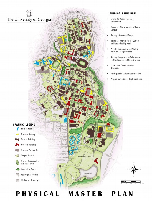
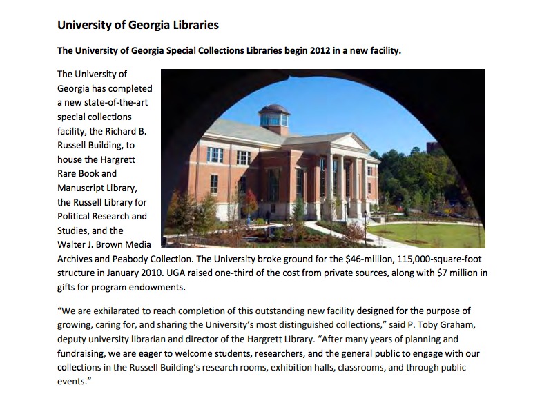
This map shows the master plans for the University of Georgia as of 1995. The map displays the buildings that embody the university which include: housing, parking decks, academic and other university buildings. It also shows the buildings within these categories that have been proposed for construction. A ledger is displayed to label the buildings. At this point in the universities history there are many areas where buildings have been proposed, specifically on south campus. This large area in the southern part of the campus is somewhat underdeveloped relative to the proposed construction. Most of the proposed buildings in this area consist primarily of academic and other university buildings. In the northern area of the campus, there are less buildings that are proposed for construction. The majority of the buildings proposed on north campus consist of housing buildings. Also included in this map are guiding principles that display the goals for the structure of the campus. They outline things such as connecting all areas of the campus, solutions to traffic and parking concerns, and the need for these certain buildings to be constructed. The plans for the campus at this point in time as displayed in this map, differ from the actual form of todays campus. An example of this would be the special collections library. This building is located northwest of Sanford stadium and is not shown to be proposed for construction at this point. The structure of the surrounding roads also seems to differ in the area where the special collection library stands today.

