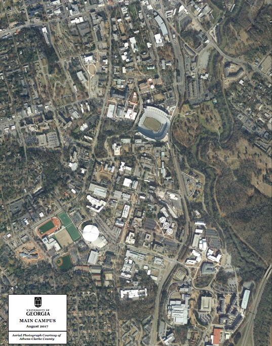
The University of Georgia Campus 2017
This image of The University of Georgia’s campus is an aerial view that clearly displays all of the Universities infrastructure. The image shows the location and surrounding area of many buildings that have previously been planned for construction as shown in the 1995 plans. The completed special collections library can be seen on north campus. The northern part of the campus is dense with buildings, the most significant structure being Sanford stadium. South campus shows many new buildings constructed in the previous 20 years. There are many new academic facilities as well as buildings for student housing. The south campus is much less dense than the north although there are many more buildings spread out through the larger area. The biggest difference between the north and south is the amount of natural landscape found in the southern area that is absent in the north. One of the largest buildings constructed on the southern part of the campus is the science learning center. This building underwent construction in 2014 and is one of the universities largest academic buildings. The science learning center can be seen in this aerial view of the campus directly south of Sanford stadium. The plans for construction of this building seem to be absent from the 1995 plans as other plans are shown in its place. This is just one example of several other buildings that differ from the previous plans of south campus.

