Map of Theban Necropolis
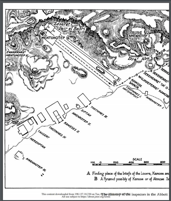
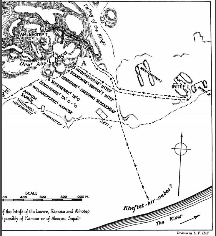
This is an image of a map drawn by cartographer by L.F. Hall. The map was visualized and explained as the cemetery discussed in H. E. Winlock’s paper, drawn to help better understand the Tomb of the Kings in Seventeenth Dynasty. These kings were not as rich, famous, or instrumental as the Pharaohs which is why there are not great pyramids or upper monumental burial markers remaining. However, these deceased had enough power and title to received their private burial chambers so they were able to live comfortably in the afterlife. The map is a drawing of the segmented areas in the Theban necropolis. He identities particular areas with “A” or “B” in order to separate the grouping of areas in the necropolis site. This map focuses on the line of tombs and not the Valley of the Kings, which is where the well-known royalty of Thebes’ deceased is found. Many of the marked locations are names of the royal nobility found in their burial chambers. The tombs between the map keys “A” and “B” regard the lesser royalties, the highest noble rank starting at area “A” leading down to the lowest rank at point “B”. The Lords of the West, the rest of the tombs in that line, were buried decades later, shying away from the original burial grounds and thus, expanding the Theban Necropolis. At the bottom right corner of the map is the Nile River. Arguably, the most wealthy and influential burials outside of the Valley of Kings was for Mentuhotep III and Amenhotep I since their massive, distinct burial grounds reflect their status, wealth, and power.
Citation: L.F. Hall. [map]. Plate XIII. H.E.Winlock “The Tombs of the Kings of the Seventeenth Dynasty at Thebes”, The Journal of Egyptian Archaeology, vol. 10, no. ¾, 1924.


