Plans for Savannah
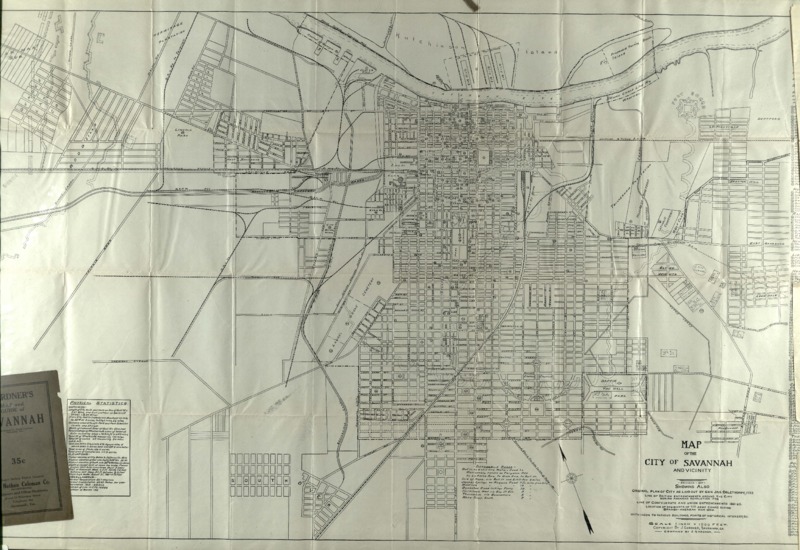
Gardner's Map of the City of Savannah and Vicinity shows the original layout plan of Savannah by Oglethorpe. The map includes numbering of various buildings, parks, and other important landmarks. According to “The Oglethorpe Plan: Enlightenment Design in Savannah and Beyond,” Oglethorpe’s plan was for Savannah to reflect an “utopian agrarian society that would preserve and nourish fundamental principles of the British nation” (Wilson, 37). Since Oglethorpe wished to preserve these principles, his idea for Savannah was similar to that of the British Empire. The model that influenced the planning of both Savannah and the British Empire included elements of planned urbanization, civic squares, wide streets and plots reserved for public purposes (Wilson, 69). Gardner’s map follows this model plan as it shows town squares and planned urbanization. The old cobblestone streets in Savannah also reflect the idea of wide streets. The desire for a town with equal economic independence and opportunity accounts for Savannah’s grid-like structure. The city of Savannah was planned alongside the Savannah River. The river is described as the “prime benchmark” and a “symbolic cornerstone” for the plan of the city (Wilson, 64). Oglethorpe placed the city near the river, believing it would create a mutual relationship between Georgia with South Carolina. Although he had good intentions, this did not work out as planned; South Carolina saw the settlement of Savannah as a barrier for trade. Gardner’s map also displays the location of the regiments of the seventh army corps during the Spanish American war, another difficulty Oglethorpe faced during the settlement of Savannah. Oglethorpe had established good relations with the governor in St. Augustine in 1736, but when they governor was replaced, the “Spanish reasserted their historical claim” to Georgia (Wilson, 127).
