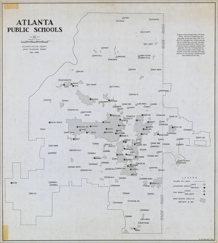
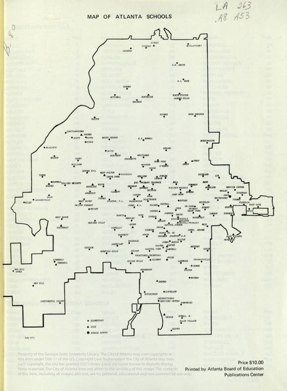
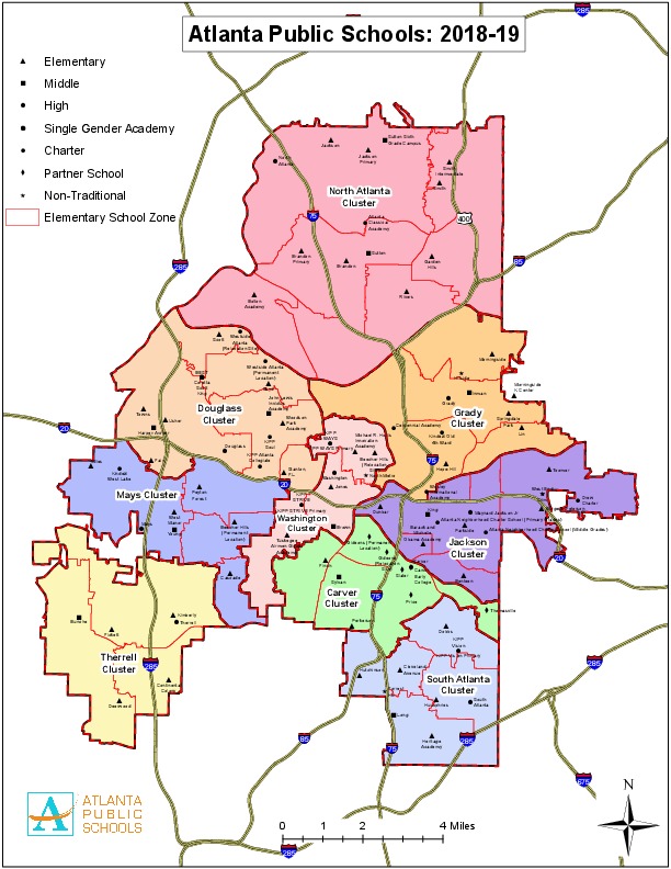
Map of Atlanta Public Schools in 1958, 1971, and 2018
It is most commonly known that maps are used for spatial awareness, the tool used from getting one place to another, however, many maps hold deep lines of history and symbolism through their roots. When studying the desegregation of Atlanta public schools, it is crucial to also study the ways of the South and their methods of turning desegregation around within the education system. When looking at three different maps, one from 1958, one from 1971, and one from 2018/19, it is clear that times have changed, no matter the efforts of the South. The legends that are on the maps are the first signs of change found between the three maps. On the 1958 map, there is a legend which has symbols for elementary schools and whether the school is “white” or “nonwhite”, different symbols for high schools and whether those schools are “white” or “nonwhite” and have areas “occupied chiefly in 1952 by nonwhites”. In 1971, we have only three symbols on the legend, elementary, middle, and high school. On the 2018 map, we have the symbols, Elementary, Middle, High, Single Gender Academy, Charter X Partner School, and Non-Traditional. Even just the legends of the maps show that the times truly changed, for the 1958 map differentiates schools based on color, the 1971 map differentiates schools based on grade level, and the 2018-19 map also differentiates based on grade level, however shows the growth and the advancement of different types of schools other than the typical public school. This shows the focus that was held on education, for both before and shortly after the 1954 Brown vs. Board of Education case there was an attempt to discriminate the education of children based on their color. Times truly have changed since those days, however, the segregation that was still relevant even years after the case in Southern states, whom were not content with the case, prevailed. What can also be seen in these maps is the large number of high schools in the inner cities while the edges have very few. The edges of the city are where most of the white Atlantans live and where many private schools are housed, such as Westminster and Lovett. In the city center in 1958 and 1971, there are public schools everywhere. However, by 2018, the number has reduced drastically due to large numbers of school closings during the 1980s and 90s.
Sources
Atlanta-Fulton County Joint Planning Board. Map of Atlanta Public Schools. Map. Atlanta, GA. 1958. Print.
Atlanta Public Schools. Map of Atlanta Public Schools. Map. Atlanta, GA. 1971. Print
Atlanta Public Schools. Map of Atlanta Public Schools. Map. Atlanta, GA. 2018. Print


