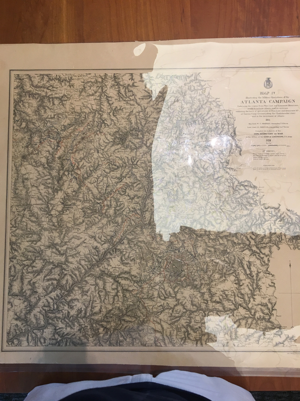
Illustrating the Military Operations of the Atlanta Campaign
This military map illustrates the the military operations of both the Confederate troops and the Union troops in the city of Atlanta, along with the surrounding area. The legend of the map shows that the red lines represent the works and paths of the Confederate troops, while the blue lines represent those of the Union troops. This map helps us understand just how the Union was able to take siege of Atlanta and destroy it, crippling the Confederacy for good. Although the Confederates had the city almost completely surrounded, General William T. Sherman and his army was able to get past the Confederate blockade and take control of Atlanta. This was a decisive point in the Civil War, because Atlanta was such a hub for transporting different military materials, such as guns, ammunition, clothing, medical supplies, and even food and water to other parts of the South. Once Sherman and the Union had Atlanta under their control, it was almost too easy for the Union to cut off the flow of materials to and from all across the Confederacy. From Atlanta, Sherman and his troops made a beeline to Savannah, his infamous March to the Sea, destroying almost everything and everyone that got in his way. The Confederacy’s biggest form of revenue was crops, especially cotton. To make sure that the revenue stream was cut off, he and his army burned all the crops on his way from Atlanta to the Coast. The giant that was the South had been slain, and Sherman wanted to make sure it stayed that way.
Source: Map[s] Illustrating the Military Operations of the Atlanta Campaign.” Maps Illustrating the Military Operations of the Atlanta Campaign ... 1864, Am. Photo-Lithographic Co., 1874.
