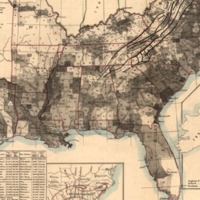
Slave Distribution Map
Dublin Core
Title
Slave Distribution Map
Subject
- Slaves--Southern States--Maps
- United States--Southern States
- United States--Southern States
Description
This map displays the distribution of slaves.
Creator
Steinwehr, A. von (Adolph)
Publisher
A. von Steinwehr
Date
1860
Contributor
Steinwehr, A. von (Adolph),
Rights
Library of Congress, Geography and Map Division.
Format
Image, 36 x 41 cm.
Language
English
Type
Map
Coverage
Slave Map
Still Image Item Type Metadata
Original Format
Image
Physical Dimensions
1 map : col. ; 36 x 41 cm
Files
Collection
Citation
Steinwehr, A. von (Adolph), “Slave Distribution Map,” Mapping Nature — Fall 2018 ENGL1102 Composition, accessed September 22, 2024, https://sarus-sapien.net/fall2018-omeka/items/show/208.
