Atlanta NAS Highway Project
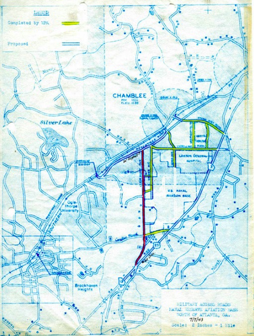
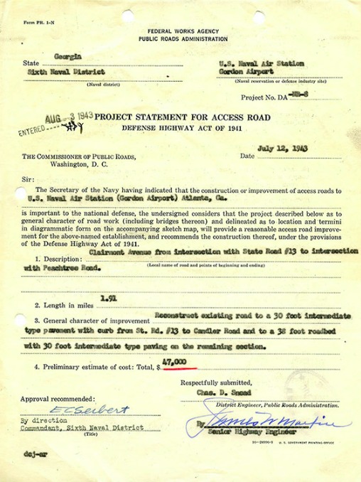
The image is displaying the plans for the Defense Highway Act of 1941, which was intended to improve the roads and highways in the Chamblee-Tucker area, a suburb of Atlanta. This improvement of local Atlanta roads was backed by President Roosevelt’s request that $25 million be used to fund the improvement of networking highways and improvement of bridges across the country (Weingroff). The manufacturing sector in the south (that including Georgia) was beginning to vamp up again after the Great Depression, which would call for better transportation systems in its major cities. In a more detailed report of the plan, the system must be a “strategic network or highways” (Weingroff), and the Federal Works Administrator may change the location of any highway route between control points. This background knowledge of the image is valuable in understanding how the highway systems of the metro-Atlanta area were formed and how they continue to expand in order to meet the needs of the time period, and this plan took place during a time of war. It is also important to point out the highlighted portions of the map, as there are visible highlights around the U.S. Naval Aviation Base and a hospital (its purpose unknown, but it’s plausible that it may have been used for soldiers). This gives proof to the importance of this area to the war effort, and when looking at a current map of Atlanta, this area is now the Dekalb-Peachtree Airport. Although we are not currently in a time of war, this time-period was crucial in shaping the way our city is structured, as highway lines are clearly defined so that they would feed into the naval base and the hospital.
“Highway History.” Edited by Richard Weingroff, U.S. Department of Transportation/Federal Highway Administration, www.fhwa.dot.gov/infrastructure/hwyhist06e.cfm.

